


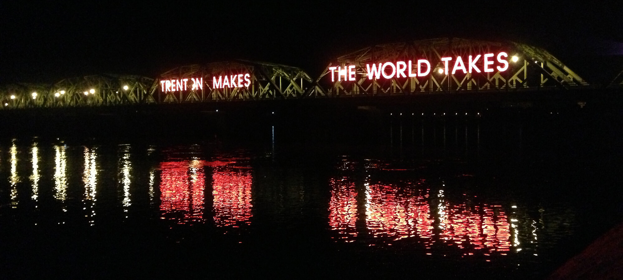
“Trenton Makes – The World Takes.” Robert Venturi once said the glowing neon sign on the Trenton Makes Bridge (officially the Lower Trenton Bridge)—connecting Trenton, New Jersey with Pennsylvania—captivated his imagination as a child, sparking a nascent interest in the relationship between architecture and communication. After a long history, however, the days when “Trenton Makes” are long gone. The former steel-manufacturing hub fell into a steep decline midcentury, losing over 25 percent of its population and a significant portion of its tax base.
Today, officials are hoping to buck this trend all too familiar for many rust belt towns. This August, Trenton planners received a $1 million grant from the Delaware Valley Regional Planning Commission to re-imagine the city’s 5.5 miles of shoreline along the Delaware River, which stretches 300 miles between the Catskill Mountains in New York to the north and Delaware Bay in the south.
Trenton Mayor Reed Gusciora said the study will focus on State Route 29 between Landing Street, just south of Trenton Thunder Ballpark (until recently Arm & Hammer Field), and north of Calhoun Street, according to P. Kenneth Burns, a local PBS reporter. Trenton’s Route 29 Boulevard Project, a program to better connect the city’s 90,000 residents with its waterfront, is still in early developmental stages. Gusciora’s administration just issued an RFP seeking engineers to conduct a feasibility study. It’s yet to be seen how the highway will be reconfigured into an “urban boulevard.”
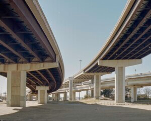
Prior to Route 29’s completion, much of the waterfront property was home to Stacy Park, a popular destination for Trentonians cut off from the city center by the four-lane highway in the 1950s. After the state purchased the land, areas around the highway were filled in with the Capitol Complex—most of which is surface parking. Since then, there has been no major integration between the city and waterfront—not to mention years of ecologically catastrophic pollution levels—except for major floods. The expressway was voted one of the “ten worst urban highways” by the Congress for New Urbanism in 2017.
Older rust belt cities sliced in half by highways around the U.S. have made similar announcements following the release of the Biden administration’s $2.25 trillion infrastructure plan in 2022. “The President’s plan includes $20 billion for a new program that will reconnect historic neighborhoods cut off by historic investments and ensure new projects increase opportunity, advance racial equity and environmental justice, and promote affordable access,” The White House said when the program was announced.
Today, Route 29 in Trenton joins the Claiborne Expressway in New Orleans, I-81 in Syracuse, New York; I-5 in Portland, Oregon; I-980 in Oakland California; and others as potential sites for rethinking highways. For Gusciora, rethinking Route 29 is both an opportunity for better quality of life as well as new housing and commercial activity.
“We used to have 135,000 people in the city, and now we’re down to 94[,000,]. Many people have left, along with the jobs,” Gusciora told local reporters. “[This] planning grant will enable us to redesign the highway … that goes along our waterfront to essentially bow it out so that we can recapture more waterfront. That will be an economic viability for the city.”


_in_Trenton,_New_Jersey.JPG”)